rHEALPixDGGS
rHEALPixDGGS is a Python package that implements the rHEALPix discrete global grid system (DGGS): a hierarchical partition of an ellipsoid of revolution into equal-area cells, built on the rHEALPix map projection.
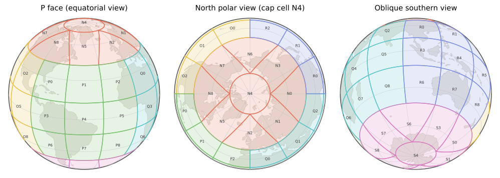
Fig. 1 The resolution 1 cells of the (0, 0)-rHEALPix DGGS on the WGS84 ellipsoid, colored by their resolution 0 cell and labeled with their cell addresses. Left to right: an equatorial view facing the P face; a north polar view, with the circular cap cell N4 surrounded by the four dart cells; an oblique southern view.
Key API entry points
Entry point |
Purpose |
|---|---|
A grid system on a chosen ellipsoid: cell lookup from points and regions, grid generation, cell areas and widths. |
|
A single cell: geometry (the centroid as its position, the nucleus that indexes it, vertices, boundary), hierarchy (parents, children), neighbors, and topological predicates. |
|
H3-style conversion between longitude-latitude points and cell addresses. |
|
Cells covering a polygon. |
|
Cells touched by a linestring. |
|
Rings and disks of cells around a cell. |
|
Merge complete groups of sibling cells into their parents. |
|
The underlying ellipsoid of revolution (WGS84 and unit-sphere instances predefined). |